Friday, March 18, 2011

Bloody and Muddy at the 2011 Dirty Duo.

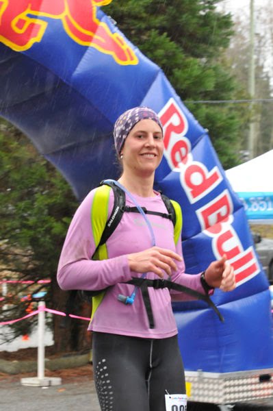
Mountain biking, trail running, or both. 15km, 30km or 50km. At the 2011 Dirty Duo the options were endless and competitors were able to set the bar to whatever challenge they wanted. I drew the line at 25km for my first race of the season.

Before the race, rumours circled amongst first-timers of steep climbs, technical descending, roots, rocks, mud holes resembling quicksand and sections of snow and ice. Perfect!
As the race got underway though, the North Vancouver trails charmed me with their rolling, cushion-soft terrain, rainforest green, long sections of boardwalks and just enough technicality to keep me on my toes and focused on the race at all times. With a total ascent of 2600m, the course was more than rolling, but luckily the climbs never broke the spirit! Camaraderie was great amongst racer, aid station support excellent from the event organisers, and I finished with enough mud on myself and even a scrape here and there to call myself a true trail runner.

I finished the race in 2:56 hours and placed 12th female in a race with some awesome female runners who always continue to inspire me. Always an inspiration to me, my fabulous coach, Jen Segger, set a smoking pace and came in second by 45 seconds. Her training is definitely starting to pay off and I can feel the benefits of the strength training translating to the trails. You can see Jen's website here.

I would definitely recommend this race to anyone wanting to get into the trails and enjoy a fun race with lots of like-minded runners. You can download the Garmin file for the 25km course here.


Monday, January 3, 2011

Freestyle Snowshoeing to Cloudburst Mountain

After a solid 2 weeks of grey, drizzling weather, the bright blue skies called for a spectacular adventure outdoors. We decided on spectacular views, snow and 4.5 hours of uphill climbing in snowshoes to celebrate the sun (and some much needed Vitamin D). Our destination: Cloudburst Mountain, a single bald dome rising at the end of Squamish Valley, its summit giving 360 degree views of the Sea to Sky corridor - basically, snow-capped mountains as far as the eye can see. Not too bad right!?

As we would be freestyling most of the way, we mapped our route to carry with us on a Garmin Forerunner watch, ensuring that we would reach the ridge that we could then walk on to the summit, thus avoiding any potential avalanche areas.

Our route below (as mapped using Google Earth):


Squamish Valley :


Hiking up a Forest Service Road (FSR) to 1000m:


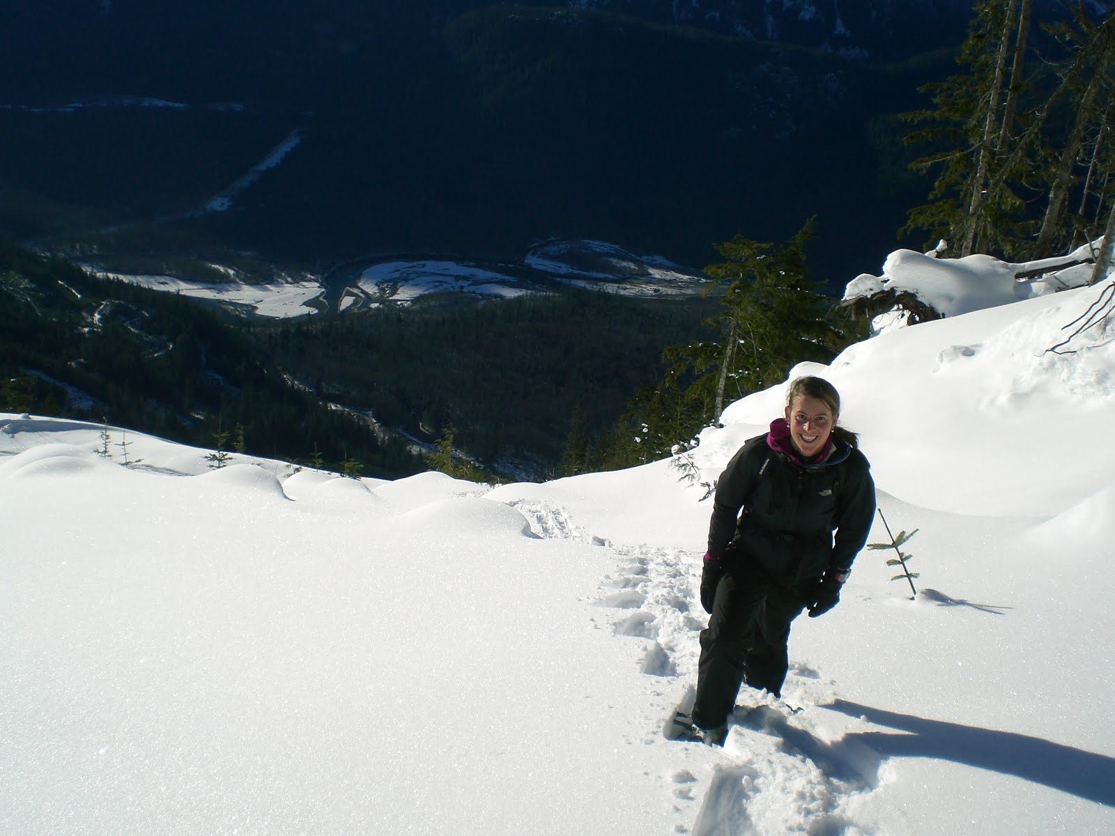
Starting the Freestyle climbing to get onto the ridge, Squamish Valley behind me:


Snowshoeing through powder snow is hard work, especially uphill (1 step up, 2 steps down...).


Finally out of the tree-line and into the white, alpine stillness. Here the snow was frozen hard on the surface from the wind, making for much easier climbing:


Along the ridge, almost 360 degree views:


Cloudburst Mountain (still at least 2 hours away):


In the end we didn't reach the summit of Cloudburst. Not enough daylight and our late start meant that we turned around after reaching the ridge. Nevertheless, we got our sun, views and enough powder snow to last us though a few more rainy days.

Friday, November 19, 2010

Winter hike to Blacktusk


Snow-covered Blacktusk sitting in the saddle:


Taylor Meadows:


The view to Garibaldi Lake:


Winter hiking:


Garibaldi Lake:


Wednesday, November 3, 2010

Scuba Diving Maui

A perfect twilight morning - the full moon glowing as the sun barely rises behind the 3000m Haleakalà volcano. Waiting at the boat launch is the specially crafted dive boat of Ed Robinson's Diving Adventure, macadamia nut coffee and several other keen divers all stoked about getting under the calm shores of the south coast of Maui. 20% of Hawaiin fishes are found nowhere else in the world, so a dive here means that you are likely to see things you will not find back home.

Our first dive is at the crescent-moon shaped Molokini Crater, a volcanic crater about 20min offshore. For more information about this area click here. The current is strong and we plan a drift dive. The idea is to let the current do all the work, to relax and look out for the BIG fish - white tipped reef sharks, turtles and rays.


The endemic Hawaiian Dascyllus below:


The endemic Spotfin Scorpionfish below (if you can find it!):


Our second dive was at the wreck of an old WWII landing craft that was now a multi-coloured reef. In rusted out holes you could find hidden fish, eels and spiny urchins.


Diving alongside a fat sea cucumber below:


The endemic Garden Eels below burrow into the sand and then slowly raise their heads out up to 3ft to feed on zooplankton:


If you do find yourself in the lucky situation of being in Maui, take a chance to explore the unique world underwater. I would highly recommend Ed Robinson's Diving Adventures. I was amazed at the level of service they provided: perfectly brewed coffee, knowledgeable dive masters who take the time to show you lots of different sea life, an opportunity to just relax as they take care of eveything! You can find there details here. To find out more about the endemic sea life of Hawaii click here.

*Photos courtesy of Maui Scuba.

Sunday, August 22, 2010

Climbing Black Tusk

30km north of Squamish in the Garibaldi Ranges sits Black Tusk (2319m) - a squat, black pinnacle that vibrates with prehistoric energy and sticks out sorely like rotting teeth in a mouth of pearly whites. To the indigenous people of the area, it is known as "Landing place of the Thunderbird" because it is believed that its unique shape and charred appearance was caused by the lightning of the Thunderbird. Geologically, it is believed to be the lava core of a cinder-rich volcano. 

The trail to the peak of Black Tusk starts at the Rubble Creek carpark, off highway 99, and climbs through a range of amazingly different landscapes. From the carpark it is all ascent via a series of switchbacks that climb through alpine forest. The trail emerges in the Taylor Meadows (below), flattening out and leading through the blooming alpine flowers.

Below Black Tusk can been seen sitting in the saddle: 


The Glacial lake, Garibaldi Lake, located south of Black Tusk:


The sign cautions hikers that the trail has finished and that the way to Black Tusk is treacherous due to the rocky debris that form the slope. There was also still snow covering some of the flank, making for an interesting ascent and descent:


Hikers can be seen in the top left of the picture, tiny in comparison the the black rock behind them:


Looking East towards Cinder Cone and its 9km long flow of lava. The flow can be seen in the way the earth seems to spill into the valley:


Completely alone on the South summit:

Freestyle descending down the southern rock chimney: